Compass: Terra
Turn ground investigation data into site intelligence
Transform document-centric, manual processes into interactive digitalised models and automated workflows in minute. Built for the geotechnical, geoenvironmental and ground engineering professional community.
Capabilities
One product, the whole site picture
Terra brings ground investigation, contamination, and site modelling into a single workspace, turning fragmented documents into a living, queryable digital site model.
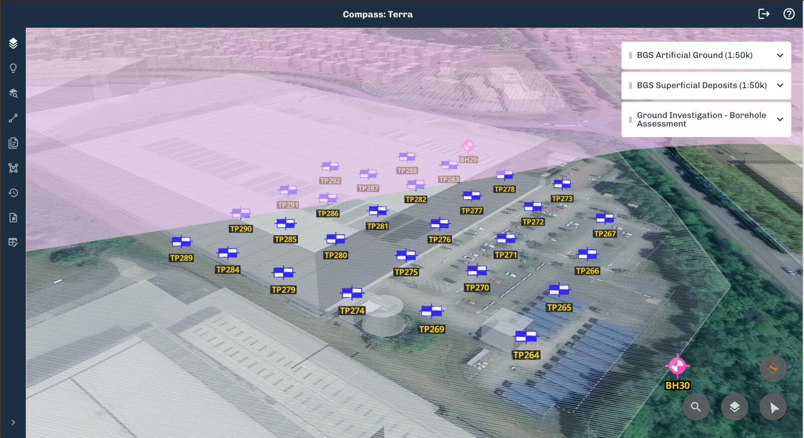
Build a Site Model automatically
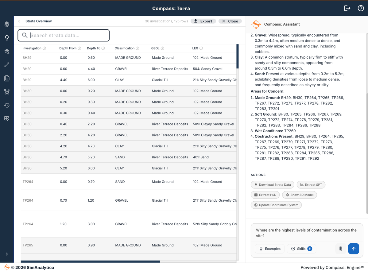
- Extract ground investigation data from PDF, AGS and Excel
- Geolocated borehole, trial pit and historical record data
- A single, structured foundation for every assessment
Understand the subsurface quickly
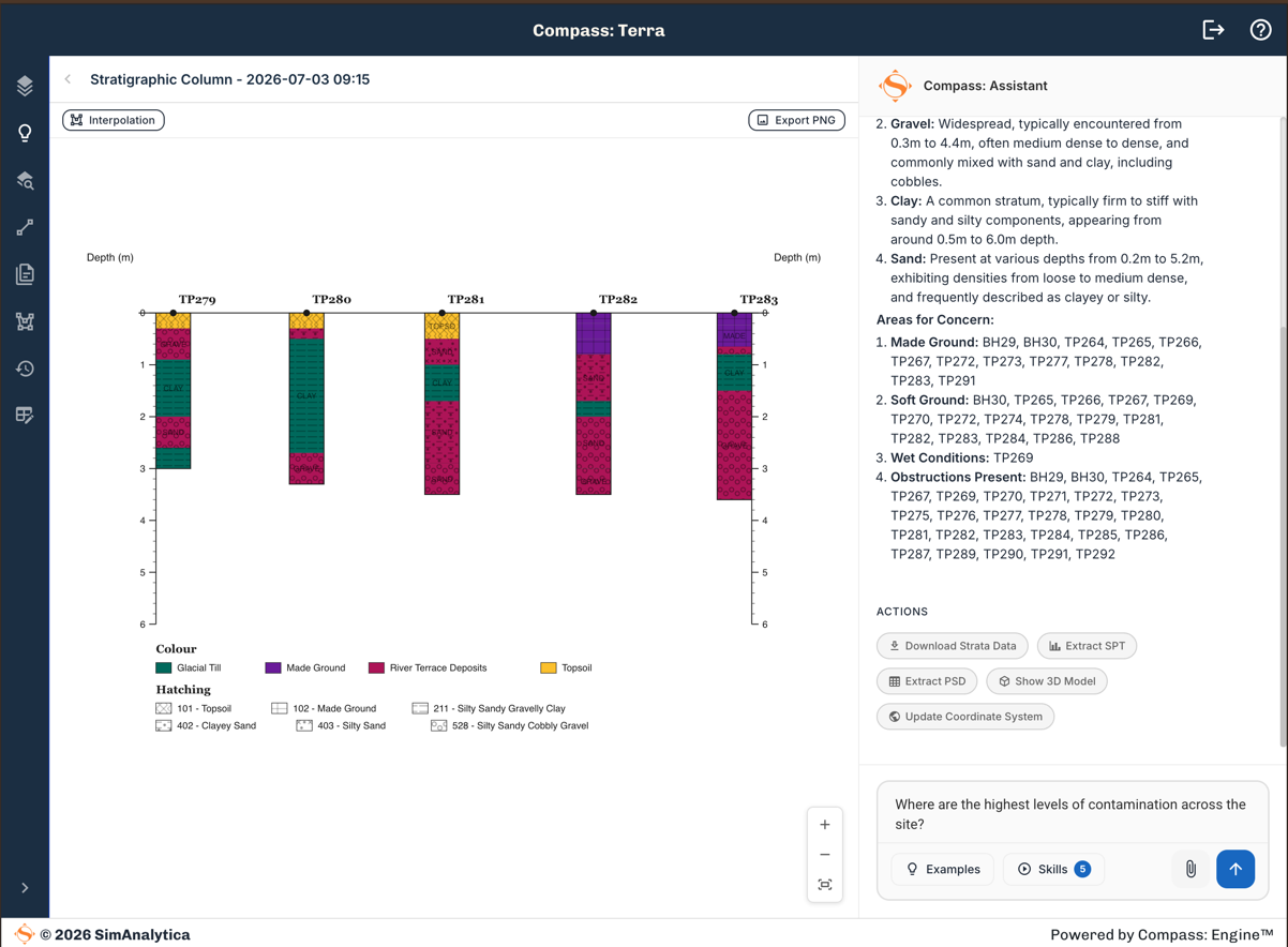
- Build Cross-sections across the site
- Review SPT plots and PSD curves
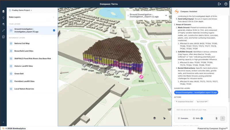
- Explore strata in an interactive 3D model
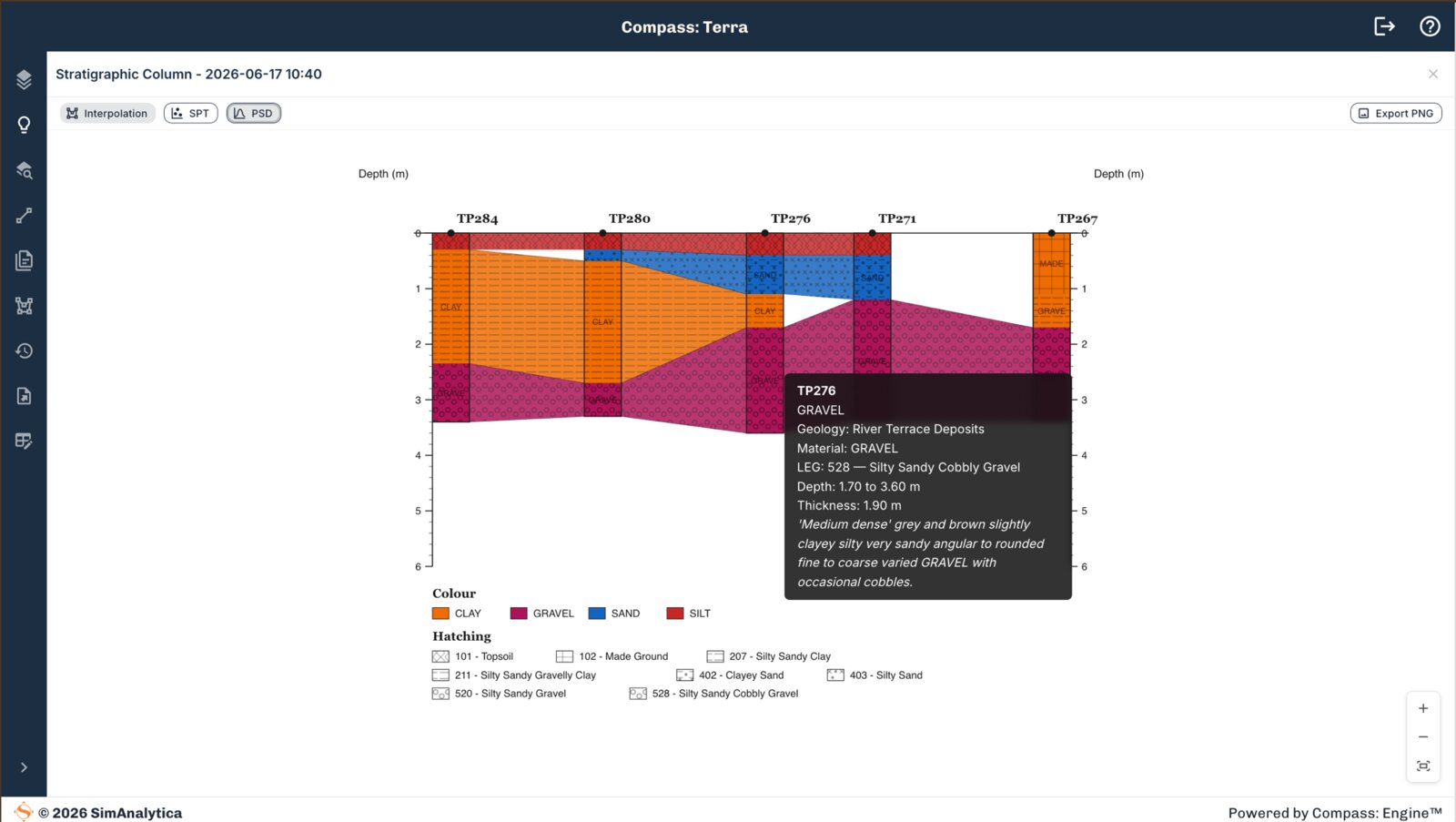
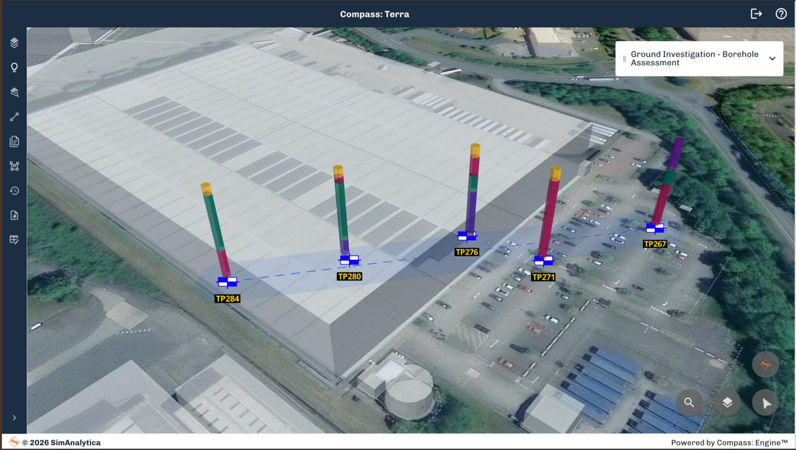
Explore and Collaborate
- Screen site risk against contextual layers like BGS, OS, flood risk and utilities data
- Share your site model with colleagues and clients in a secure workspace
- Export into your reports and workflows as AGS, GIS, CSV and Excel
How It Works
How Compass: Terra Works
Four steps from raw data to actionable insight
Import
Import all your site data: PDF reports, AGS and Excel test data
Drag and drop borehole reports, AGS files and Excel test data. Every log is extracted, structured and georeferenced automatically in seconds.
Interrogate
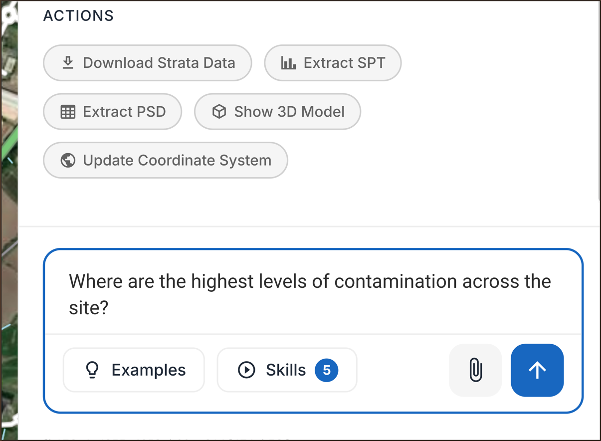
Interrogate your site with a verified AI assistant
Ask questions in plain language and get answers grounded in your own data, with sources you can check. No hallucinations.
Visualise
Visualise strata, SPT and particle size in interactive 3D
Explore strata layers, SPT results and particle size distributions in an interactive 3D model of your site.
Export
Export to AGS, GIS, CSV and Excel
Send structured, validated data straight into your workflow as AGS, GIS, CSV or Excel, ready for the next stage.

Feature Highlights
Professional and Enterprise
Start with everything you need to digitise, visualise and interrogate your ground investigation data. Scale to Enterprise for team workflows and custom integrations.
| Feature | Professional | Enterprise |
|---|---|---|
| Data | ||
| PDF borehole log extraction | ||
| AGS import & export | ||
| CAD data import | ||
| BGS 50k geology data layers | ||
| BGS GeoIndex search | ||
| BGS GeoIndex borehole log extraction | ||
| Private data layers | ||
| Live data source integration | ||
| Visualisation & Analysis | ||
| 2D mapped site view | ||
| Interactive 3D site model | ||
| Cross-sections & scatter plots | ||
| AI site interrogation | ||
| Custom strata classification | ||
| Custom calculations | ||
| AI fine-tuning | ||
| Reporting & Export | ||
| CSV & data export | ||
| GIS export | ||
| Branded report generation | ||
| Scheduled & automated reporting | ||
| Management | ||
| Single-user workspace | ||
| Team roles & permissions | ||
| Multi-project management | ||
Get Started
See Compass: Terra on your data
Upload your first ground investigation report and get structured data, a 3D site model, and AI-powered analysis in minutes.
We use cookies to analyse site usage and improve your experience. By clicking Accept you consent to our use of analytics cookies. Read our Cookie Policy.